St Oz
From Taijitu
| The Divine Republic of St. Oz | |||||
|---|---|---|---|---|---|
| |||||
| Motto: "." | |||||
| Anthem: "Դ՟գոդաք Վորետրեւվիսո" | |||||
| Geography | |||||

| |||||
| Area | 3.1 millionkm2 | ||||
| Water (%) | {{{water_area}}} | ||||
| Highest point | D'Zhrovak | ||||
| Longest river | Shpri | ||||
| Demographics | |||||
| Population | 592,659,000 | ||||
| • Density | 185/km2 | ||||
| • Growth | .7%/year | ||||
| Median age | 34.9 years | ||||
| Demonym | Ozian | ||||
| History | |||||
| Founding of Ozi'pol | January 26th, 921 BCE
| ||||
| Formation of the Divine Republic | August 6th, 349 BCE | ||||
|
December 4th, 1907 | ||||
| Government | |||||
| Capital | Ozi'pol (St Oz City) | ||||
| Official language | Ozian, Moaz | ||||
| Type | Unitary Theocratic Republic | ||||
| Legislature | Ozian Senate | ||||
| Sancta | Adara Revia Oz | ||||
| Primav | Amelio Parpaski
| ||||
| Districts | 19 | ||||
| Economy | |||||
| Currency | Paloi Equa Insorken
"Maritime Insurance Currency" (₴) (PEI) | ||||
| GDP | ₴5,419,168,000,000 | ||||
| • Per capita | ₴9,154 | ||||
| • Growth | 6%%/year | ||||
| Sectors |
18%% Agriculture | ||||
| Unemployment | 4.9%% | ||||
| Gini | 51.3 | ||||
| Development | |||||
| Life expectancy | 69.5 years | ||||
| Improved water access | 95%% | ||||
| Literacy | 100%% | ||||
| Enrollment | 99%% | ||||
| • Primary | 99.9%% | ||||
| • Secondary | 99.9%% | ||||
| • Tertiary | 45%% | ||||
| Standards | |||||
| Measures | Metric | ||||
| Date format | day-month-year | ||||
| Traffic | Right-hand | ||||
| Codes | |||||
| ISO code | OZ | ||||
| Internet TLD | .oz | ||||
| Calling code | +13 | ||||
The Theocratic Republic of Divine Ozia (Ozian:Աանքթտլժա Ռբպւվլիքը դեվ՟Ոժի)
Contents
[hide]History
The Praemian Kingdom
The Kingdom of Ozia
Rise of the Divine Republic
Moacian Occupation
Conquests
The First War with Haradrim
The Myrorian Exodus
The Second War with Haradrim
The Communist Takeover
The Haradrim Occupation
Culture
Religion
Government and Politics
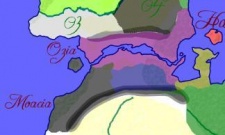
Geography
| Ozia | 1,322,000 km sq |
|---|---|
| Moacia | 921,500 km sq |
| Iadak | 564,200 km sq |
| Jutensa | 330,400 |
| Vonisia | 62,500 km sq |
| Haradrim Empire | |||
|---|---|---|---|
| Cities: | Seiyun, La Sava, St Oz City | Provinces: | Harad, Suveri, Ozia, Moacia, Jutensa etc |
| People: | ??? | Ethnic Groups: | Haradrim, Vulpines, Ozians, Moacians, Jutensans... |
| St Oz | |||
|---|---|---|---|
| Cities | St Oz City, La Sava | Provinces | Ozia, Moacia, Jutensa, Iadak |
| Government | Ozian Senate, Council of Economic Experts, Council of the Admivi, The Divine Listener, Council of Dires | Ethnic Groups | Ozians, Moacians, Jutensans, Iadakans, Fre'zhi, Kar'zhi |
| People and Groups | Blue April, Madame Ousi, Admivi Ief Graniez Qalsar, Dire Vloska Nevari, Sancta Aerieka Delzia Oz, Arpo Iseltov, Nork Parpaski, Mag Zulov | Languages | Ozian, Moaz |
| Direships | Parpaski, Iseltov, Staii, Idovk, Vehiez | Military | STIA, SOSOT, The Listener's Army, The Rats, The White Eye, The Listener's Navy, The Listener's Airforce |
